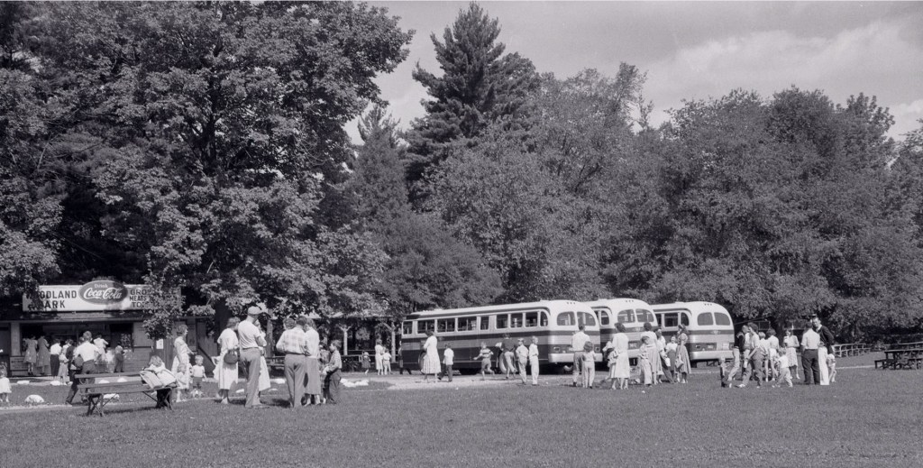
A walk along the Woodland trail reveals a community once existed here. Woodland Park provided tent camp sites and permanent seasonal cottages. The park attracted vacationing families from across the region, school teachers scheduled student bus trips and other organizations often called on the park for annual days of celebration.
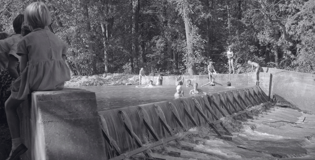
Summer activities enjoyed with friends and family included fishing, nature trips, swimming, playing ball games, hide and go seek and red rover. Piercing through the air the sounds of summertime excitement created friendships and memories to last a lifetime. Many families met here year after year forming bonds that still tie them together to this day.
First established by Nellie Lapp in the 1920’s, then purchased by Austin Reesor in 1950, the summer destination welcomed cottagers until the last ones were asked to leave in 1978. The property had earlier been turned over to the Toronto and Region Conservation Authority (TRCA), and then in 2019 the TRCA transferred these lands to the Rouge National Urban Park (RNUP).
The TRCA and RNUP secures environmentally sensitive lands subject to flooding and deterioration and also takes interest in parcels of land considered important for the betterment of public greenspaces. A program is then put in place to regenerate and establish the natural heritage of these sites. These diverse parklands then offer an ecosystem conducive to attracting flora and fauna which visitors can more closely observe.
Courtesy of Toronto Public Library
Follow the path from the parking lot towards the Little Rouge Creek and you will quickly come upon the broken-up cement walls and base used to form an old swimming pool. A four-foot-high water level was maintained by a dam constructed across the creek but still allowed water to overflow, creating an attractive water feature.
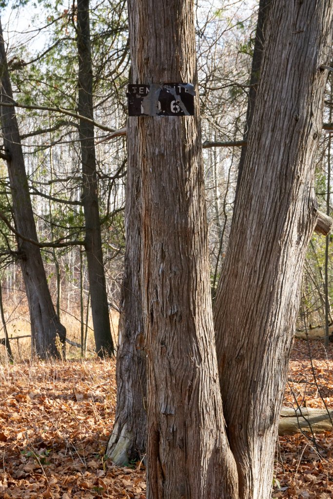
Continue walking south along the pathway next to the Little Rouge Creek. You will see a place marker attached to a tree, tent site # 6. Today’s creekside camp setting calls to mind how it might have looked in 1920 – 1940 when Nellie Lapp offered this area to weekend adventure seekers.

Cement Foundation 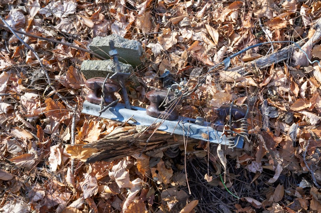
Utility Pole Hardware 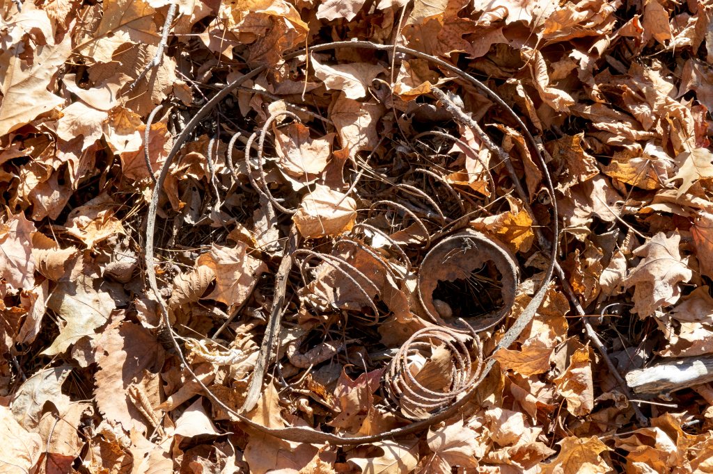
Rusted Seat Springs 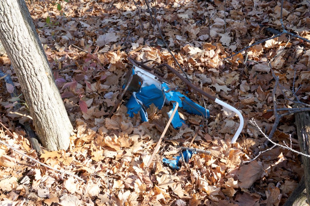
Baby Stroller
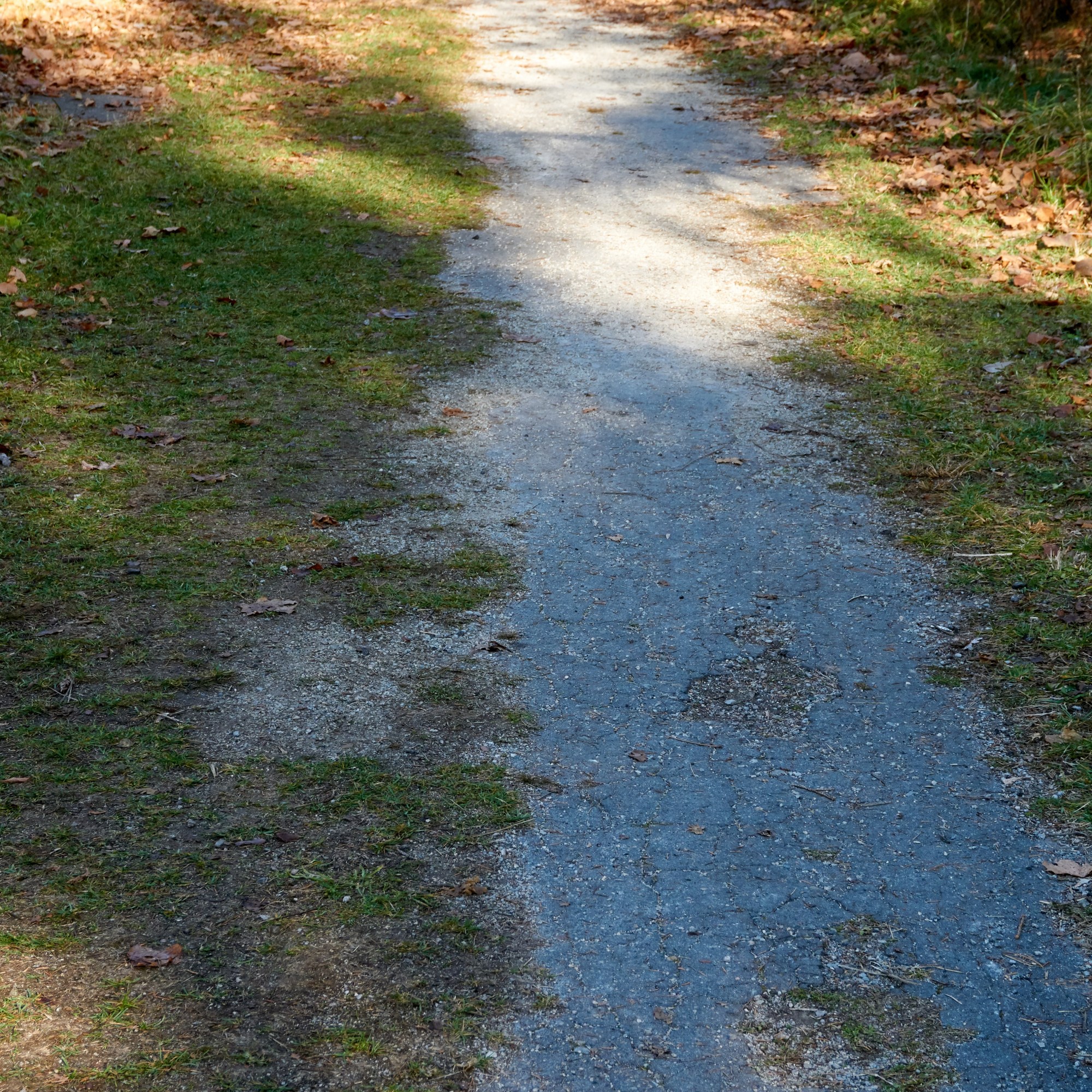
At the fork in the path, keep to the right. It takes you away from Little Rouge Creek, and guides you through the center of the Woodland summer cottage properties. The cottages and related infrastructure were all removed after the park closed leaving only some broken cement foundations, telephone poles and deteriorating debris surfacing to ground level. Driveways and property lots have been rendered mostly indistinguishable by the growth of trees over the past 42 years since the park closed. Clues hinting to the park’s former life are best discovered in late autumn, winter before snowfall and early spring.
Courtesy of Toronto Public Library
A large open field to the north is maintained by park staff and may one day be used for public activities. A second field to the south has been absorbed by time and nature. When Woodland Park was in operation the north field had pavilions, a general store, a playground and more. The park hosted annual events like the apple butter festival displaying local cooking skills with exhibits drawing in visitors from all over the region.

Walking south from the north field the partially overgrown paved driveway leads through the center of the once tight knit cottage community as you pass the location of the south field. The now reforested south field had recreational buildings serving park activities. Today you might never suspect this was once an open area. Arriving at the dirt east-west laneway marks the southern border of the former Woodland Park.
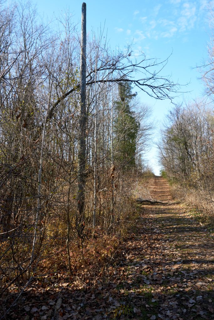
On this laneway the Woodland trail heads east. Property surveys identify this overgrown laneway as Passmore Avenue. Had the Pickering Airport been constructed as planned, Scarborough’s Passmore Avenue may have continued east to this dirt lane and possibly over Little Rouge Creek. There once were many short, disconnected sections of roads between here and today’s established Passmore Avenue.
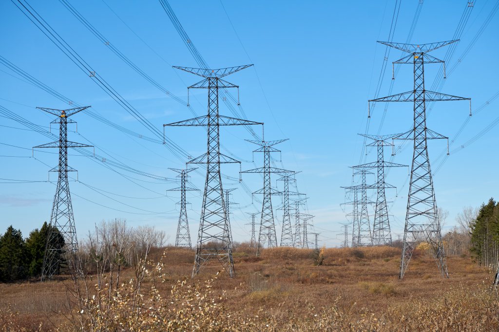
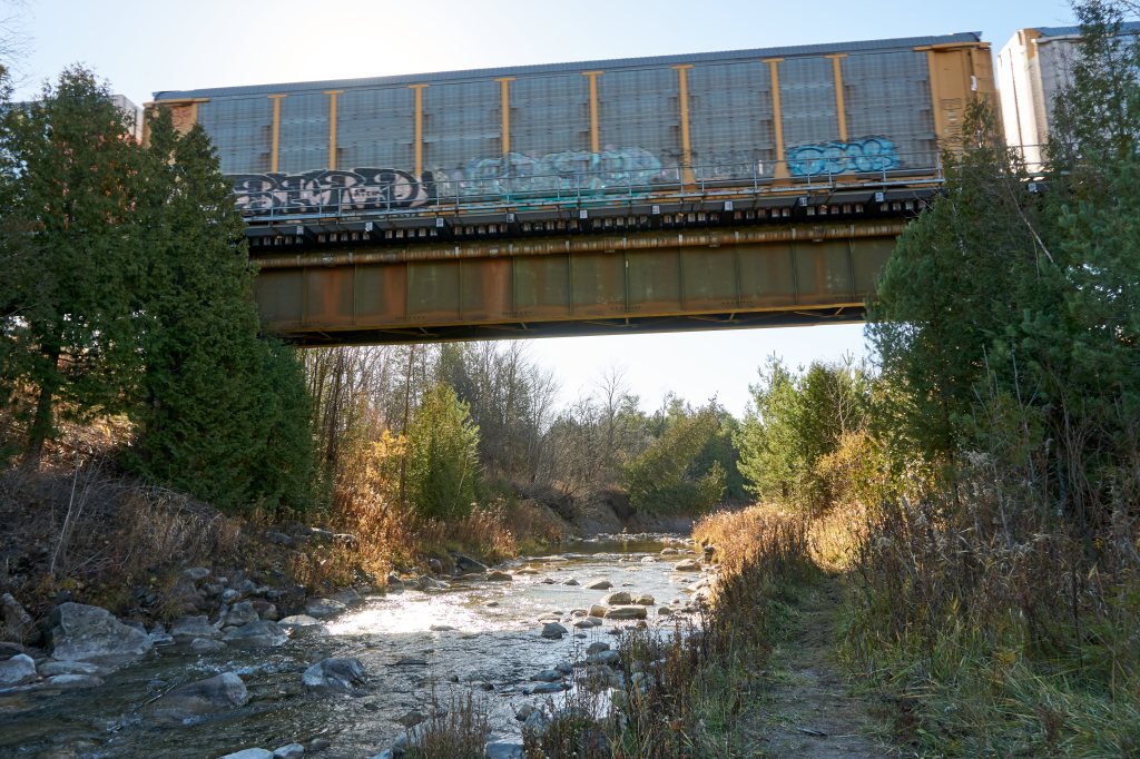
Ontario Hydro’s 140-foot-tall electrical power transmission towers are easy to see to the south of the trail. From 1950 to 1968, before the wider power corridor was created, sand and gravel were excavated from these lands by Baxter Sand and Gravel Company. A little further south from the transmission towers the Canadian National Railway (CNR) built the York Subdivision railway line between 1959 and 1965. Construction through this area started in 1963. The aerial map shows the intended route of the railway line and piers for the bridge crossing the Little Rouge Creek. The aerial map also identifies the location of the Baxter Sand and Gravel Company and Woodland Park.

Courtesy of Toronto Public Library
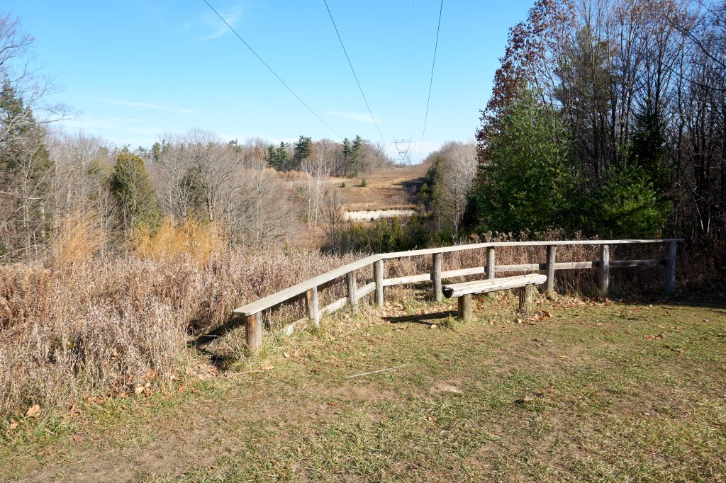
The trail began level with Little Rouge Creek with trees obstructing our sight. It ends here at an elevation of 145 feet above the creek with a clear view to the east. This lookout point was created by retreating glaciers forming a deep, broad cut in the land. Before retracing their steps to the trail head, hikers can rest, listen and watch the flowing creek and possibly catch sight of the next passing train.
Visit other daytrips

Graffiti Alley
Whether you’re from the city or a visitor with time for an unscheduled stop this is a must see. Bring your friends and strike a memorable Instagram pose. Visit Graffiti Alley in Toronto, Canada
Continue reading Graffiti Alley

The Magical Memories Store
Out with the old, in with the new. It’s an old Irish tradition. Just before midnight on New Year’s Eve we opened the back door and swept out the prior year. Then, just after midnight we welcomed in a fresh start to the new year by opening the front door. Cleaning the house before bringing… Continue reading The Magical Memories Store

Crawford Lake Conservation Area: Preserving Indigenous History
Crawford Lake, formed over 10,000 years ago, holds secrets of the indigenous Attawandaron/Wendat Nations. Archaeologists discovered longhouses and evidence of agricultural activity dating back to 1200-1400. The lake’s meromictic nature preserves a historical record.
Continue reading Crawford Lake Conservation Area: Preserving Indigenous History

Awesome Nature Park. I bet it will look even more beautiful this Autumn. Thanks.
LikeLiked by 1 person