Due to a lack of political foresight, the Newmarket Canal, constructed in the early 1900s, has more than 100 years later, transformed into a nature trail with clearly visible monuments of a failed government venture.
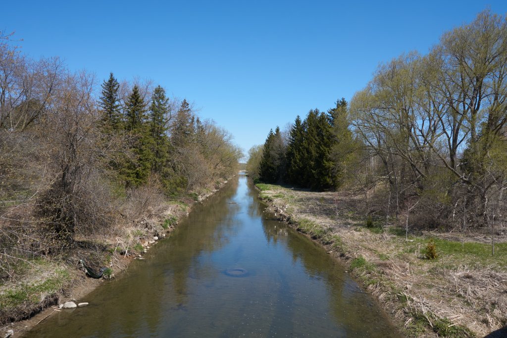
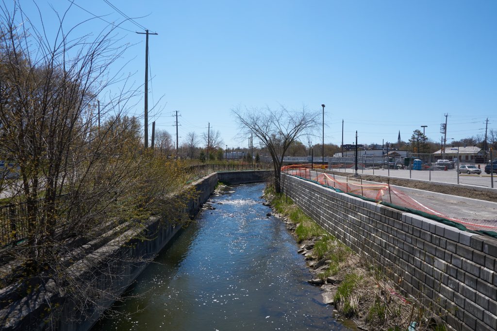
Walk or bike on the Nokiidaa Trail as it parallels the Holland River. Stop at the abandoned canal locks and imagine what it would look like today to have boaters enter Newmarket from the Trent Severn Waterway.
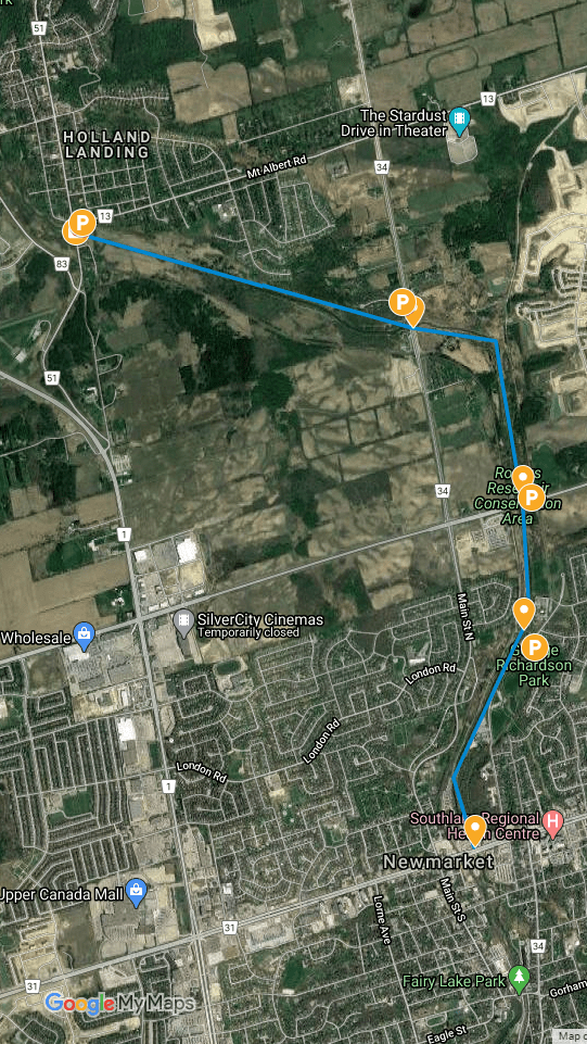
The 16 km long canal route was intended to link Newmarket to the Trent Severn Canal by way of the East Holland River and Lake Simcoe. I explored a 6 km section of the canal locks, a swing bridge, a reservoir and the filled in turning basin. Click here for the satellite map and zoom in for a closer look.
Construction of the canal finally began in earnest in 1908 after much stalling and debate from political influencers of the day. The Trent Severn Canal was nearing completion and had already been rendered of little use for commercial transport. The railway system had gained greater reach by continually building out supporting infrastructure and improving reliability for the movement of goods and people.
Before and during construction, survey after survey indicated practical use of the canal would be unsustainable. There would not be enough water to fill the canal for a full season of operation because water feeding into the head of the Holland River would be in short supply. There was doubt sufficient business existed to justify the cost of a dead-end canal. An established train line already ran parallel to the Holland River since the mid 1800’s. Regardless, proponents of the project lead by the dominant Liberal member William Mulock pressed forward with immense support from Liberal party leader Wilfrid Laurier. Locals and media commonly referred to the patronage venture as Mulock’s Madness.
Nonetheless despite the folly, many in Newmarket and vicinity benefitted by way of employment and support for local businesses as the result of William Mulock’s strong willed commitment to the construction of the canal.
“Canals, as a successful and necessary means of transport, have outlived their usefulness;”
Chief engineer, Silas Seymour, September 1883. (1)
The election of the Conservative government lead by Robert Borden in 1911 brought an end to the near 85% complete Newmarket Canal.
Make no mistake in believing this “late to the party” canal project was an isolated case of political discourse. During the 41-year (1879-1920) construction timeline of the Trent Severn Canal, just as it continues today, political agendas and axe grinding were behind almost every decision.
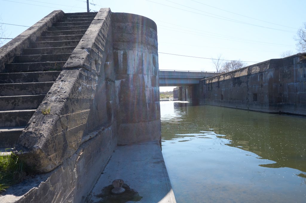
Newmarket Canal, Lock 1
Lock 1 at Yonge Street and Mount Albert Road is the only site where the Holland River flows through the unfinished lock system. Lock gates were never installed at any of the three locks. A large flood plain was created up river from this lock to assist in filling the lock chamber in a timely manner. Four rusting piers remain in place marking the location of one of the four swing gates.
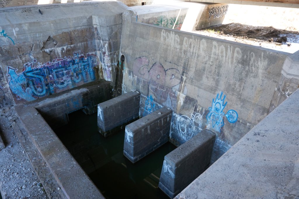
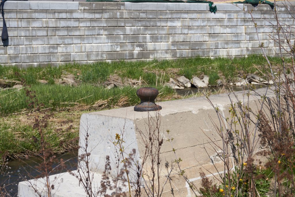
Newmarket Canal, lock 2
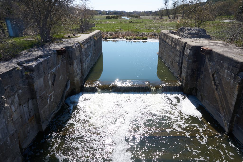
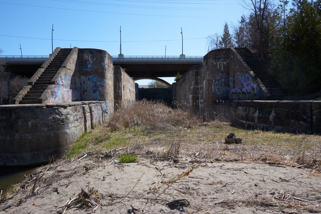
Lock 2 is at the 2nd Concession Road and Holland River. The Rogers Reservoir is located up river from this lock and was to have been used to store water when the Holland River water supply was insufficient to fill locks 1 and 2. It’s the only lock where I could stand in the dry bottom and gaze up at the massive concrete structure. The 200-foot long lock chamber is 22 feet high and has walls up to 12 feet thick.
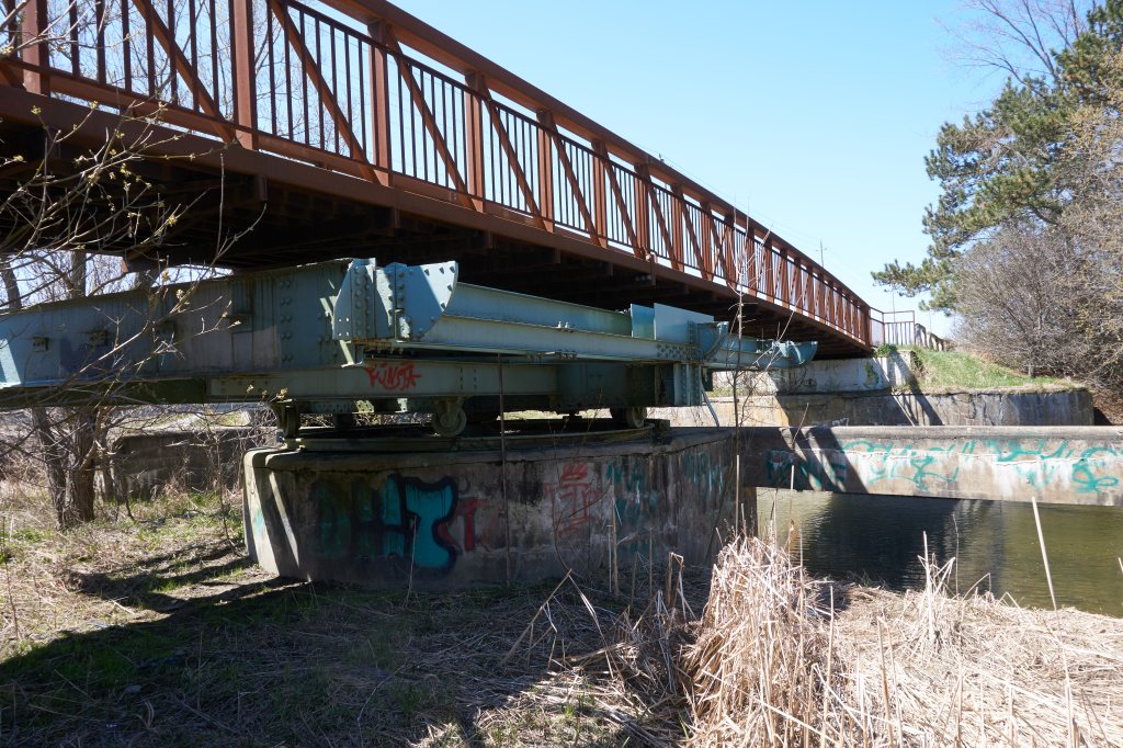
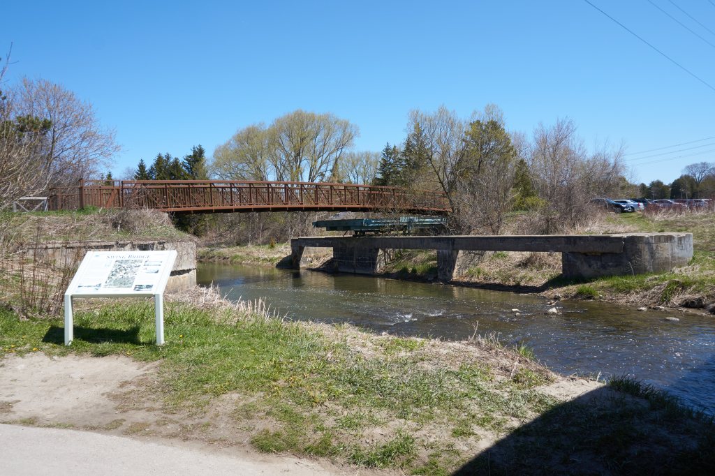
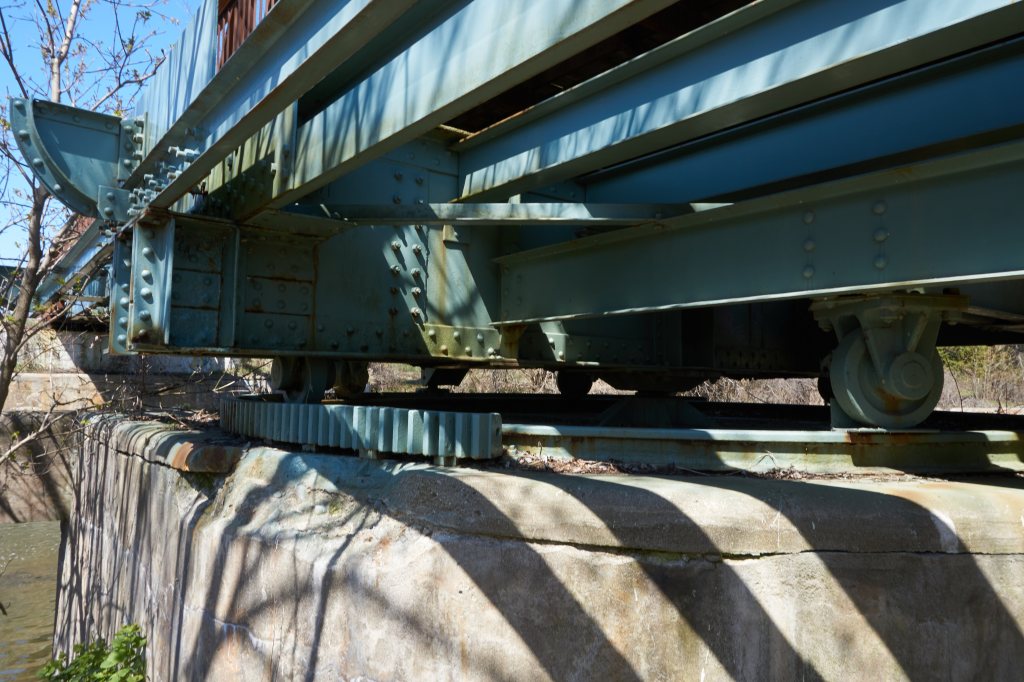
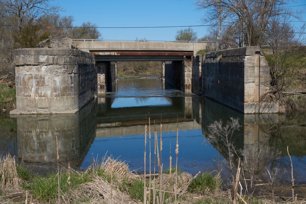
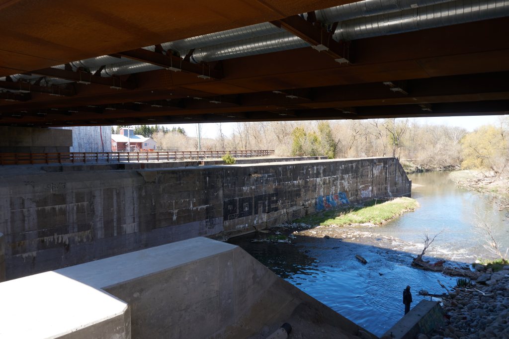
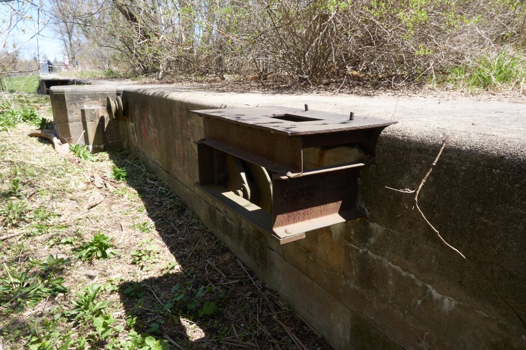
The partial remains of the last of four steel truss swing bridges designed to rotate on a turntable are situated on the eastern bank of the Holland River at Green Lane. The hand cranked gearing system is in its original location beneath the current pedestrian bridge.
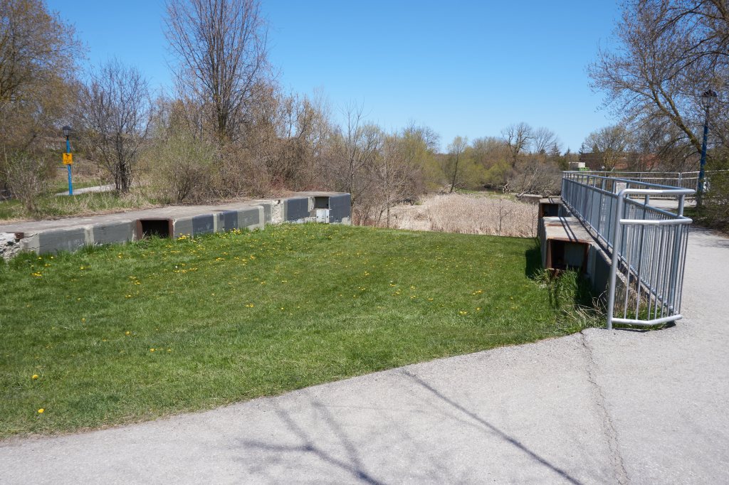

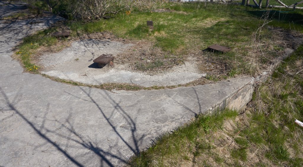
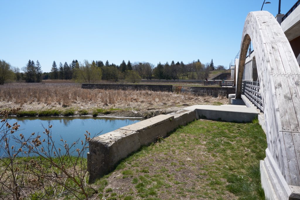
Lock 3 is at the Mabel Davis Conservation Park located along the Bayview Parkway. In order to make the park family safe the lock was filled in many years ago and protective fencing installed at dangerous ledges. Visitors unfamiliar with the Newmarket Canal’s history will see long sections of cement walls projecting a few feet from the earth and some mechanical components at ground level. The most obvious remaining evidence of this canal are the main and auxiliary spillways allowing unconstrained passage to the Holland River.
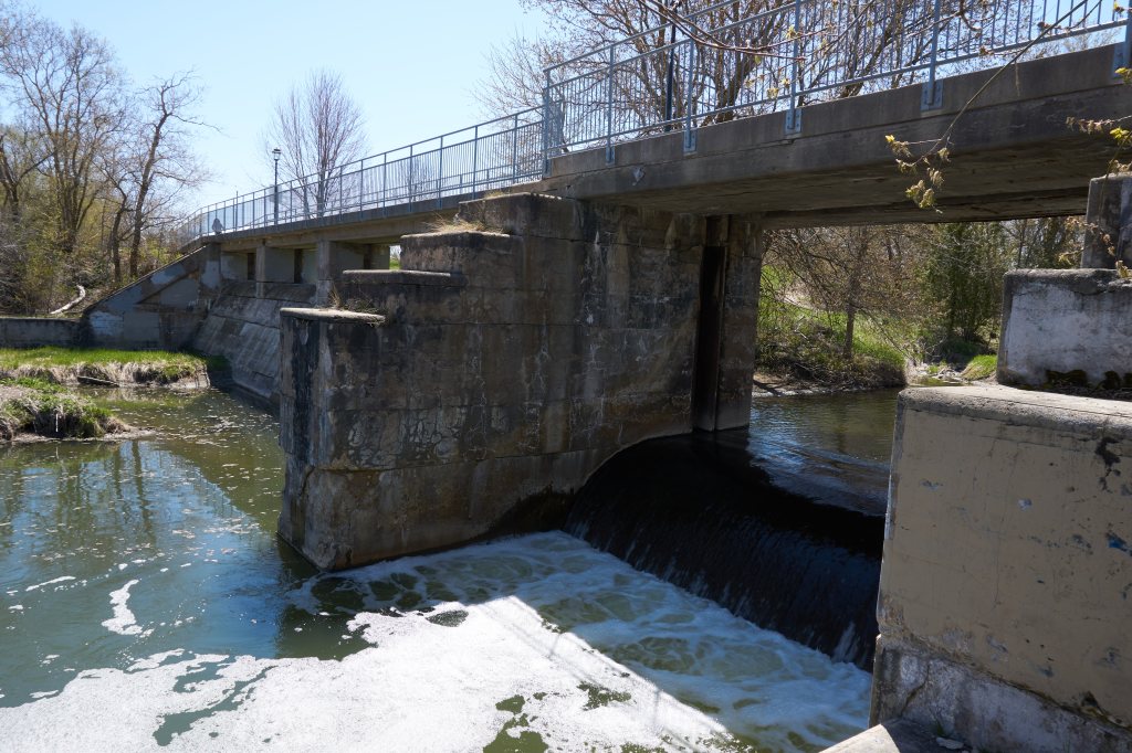
To the right of the canal photo above is the parking lot for the Tannery building at Davis Drive and the Holland River. The now filled in turning basin once extended well into the parking lot area. The turning basin was the end of the canal route.
The canal may have been a blemish on Sir William Mulock’s career but did not diminish his dedication to this community and country.
- Lawyer.
- Postmaster General.
- Chief Justice of the Exchequer Division of the Supreme Court of Ontario.
- Chief Justice of Ontario.
- Vice-chancellor of the University of Toronto colleges.
- Chancellor of the University of Toronto colleges.
- Organized the federal Department of Labour.
- Negotiated to establish a telecommunications cable linking Canada, Australia and New Zealand.
- Advocated for government ownership of Bell Telephone Canada.
Notes
(1)Report of the state Engineer, Canals of New York. 1883. p33.
Bibliography
Angus, James (1998). A Respectable Ditch: A History of the Trent Severn Waterway, 1833–1920. McGill-Queen’s Press.
External links
William Mulock Wikipedia.
AllTrails Nokiidaa Trail Guide

It’s fascinating how history can be seen through these remnants.
LikeLike
It’s nice to see some oldcanals getting a new lease of life.
LikeLiked by 1 person
Definitely. It was only by chance I discovered the first canal while on a Sunday drive.
LikeLiked by 1 person
It is a shame that they haven’t put these canals to better use. Pleasure crafts or canal boats serving meals etc would be a fun thing to do with them. Similar to Scandinavia.
LikeLike
Yes it certainly is “Something to Ponder About”.
LikeLike
You got that right, Kevin.
LikeLike